


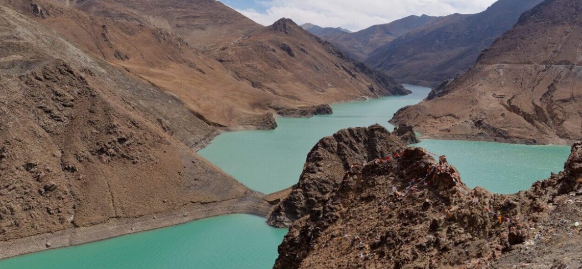
On October 22, 2026, a powerful magnitude 7.0 earthquake struck Baqing County in Nagqu, Tibet, killing at least 16 people, injuring dozens, and destroying hundreds of homes. According to the US Geological Survey (USGS), the earthquake resulted from movement along a normal fault within the Tibetan Plateau, where the continuing collision of the Indian and Eurasian tectonic plates creates enormous geological stresses. The plateau is still being pushed upward and stretched eastward and westward.
This was no isolated event. Since 1900, the Tibetan Plateau and its surrounding regions have experienced 29 earthquakes of magnitude 7.0 or greater. The devastating 1950 Assam-Tibet earthquake reached magnitude 8.6 and killed 4,800 people, while the 2010 Yushu earthquake in neighboring Qinghai claimed more than 2,500 lives. The latest earthquake is another reminder that the Himalayas and Tibetan Plateau remain among the world’s most geologically unstable regions.
The earthquake came less than two months after another Himalayan catastrophe. On August 26, a massive collapse of glacier ice and rock near the Nepal-Tibet border unleashed a devastating torrent of water, mud, and boulders. According to a USGS assessment, the collapse generated seismic energy equivalent to a magnitude 5.2 earthquake, while the resulting debris flow and flood traveled approximately 100 kilometers (62 miles) downstream. The disaster demonstrated how a seemingly remote mountain collapse could rapidly become a transboundary catastrophe, overwhelming settlements and infrastructure far from its source.
These two disasters, one driven by tectonic forces and the other by collapsing ice and rock, expose different dimensions of the same fundamental vulnerability.
They also raise an urgent question: what might happen if such forces struck the enormous hydropower complex China is constructing on the Yarlung Tsangpo River in southeastern Tibet? Although neither disaster occurred at the project site, both illustrate the geological and environmental hazards that major infrastructure throughout the Himalayas must confront. The question matters because the Yarlung Tsangpo becomes the Brahmaputra upon entering India and eventually flows into Bangladesh, linking the safety of China’s upstream engineering projects to the lives and livelihoods of millions downstream.
China’s project, launched in July 2025, is among the most ambitious hydropower undertakings in history. With an estimated investment of 1.2 trillion yuan (about $170 billion), it involves five cascading hydropower stations designed to exploit the river’s extraordinary energy potential before it enters India, where it becomes the Brahmaputra River, which flows through Bangladesh to the Bay of Bengal. Reuters reported that the project could eventually generate 300 billion kilowatt-hours of electricity annually, roughly three times the output of the Three Gorges Dam. Beijing presents the project as a major contribution to clean energy and economic development.
Its downstream neighbors, however, have reason to worry about consequences that could extend far beyond China’s borders. The project’s appeal and danger both stem from the Himalayas ’ extraordinary geography.
The Yarlung Tsangpo flows eastward across the Tibetan Plateau before making a spectacular turn around the Namcha Barwa massif, cutting through one of the world’s deepest river gorges. The enormous drop in elevation creates exceptional hydropower potential. But this is also one of the most geologically active regions on Earth.
The Himalayas formed from the collision of the Indian and Eurasian tectonic plates, a process that continues today. The resulting pressure has produced numerous faults, fractures, and unstable mountain slopes. Chinese geological researchers have identified several active fault systems around the Great Bend, including the Jiali, Dongjiu-Milin, and Motuo faults. A 2026 study in the Journal of Asian Earth Sciences identified evidence of prehistoric earthquakes in the Eastern Himalayan Syntaxis, including an event estimated at magnitude 7.0–7.5.
In other words, China is attempting to harness extraordinary natural power precisely where extraordinary natural instability exists. The October 22 earthquake illustrates that this tectonic process is not merely a matter of geological history. It remains active today, creating hazards that must be incorporated into the design and operation of major infrastructure.
The conventional question about dam safety is whether a structure can withstand a major earthquake. That question is important but insufficient. In the Himalayas, earthquakes can trigger landslides, rockfalls, and glacier collapses. A landslide may block a river, creating a temporary lake that eventually bursts. Another may plunge into a reservoir, displacing enormous quantities of water and generating destructive waves even if the dam itself remains intact.
Such events can occur in succession. A flood destabilizes downstream slopes, producing additional landslides and river blockages. Each new blockage can become another potential source of flooding. The entire river system becomes a chain of interconnected hazards.
Indeed, a 2026 study published in Paleogeography, Paleoclimatology, Paleoecology identified six catastrophic prehistoric outburst floods in the Yarlung Tsangpo Gorge system, caused by failures of natural dams. The findings demonstrate that exceptionally large floods are part of the river’s geological history, not merely hypothetical engineering scenarios.
Climate change compounds these dangers. Rising temperatures are melting glaciers and thawing permafrost, which help stabilize mountain slopes. As ice disappears, previously frozen rock and soil can become more vulnerable to collapse. Construction activities, including excavation, tunneling, and road building, can further disturb fragile slopes if not carefully managed.
A particularly relevant 2024 study in Geomorphology, conducted by Chinese and international researchers, reconstructed two glacial lake outburst floods in the Poiqu River basin between China and Nepal. The researchers identified ice avalanches as the dominant triggers and demonstrated how sudden floods could transform into debris flows. Their modeling suggested that a future major outburst could send floodwaters toward the town of Nyalam in less than 40 minutes.
None of this proves that China’s Yarlung Tsangpo project will fail. Nor does it establish that construction caused the August disaster in Nepal. But it shows why assessing individual dams’ safety isn’t enough. The entire mountain-river-infrastructure system must be evaluated together.
Another concern is reservoir-induced seismicity. Filling a large reservoir adds weight to the underlying rock and lets water penetrate existing fractures, potentially changing the stresses on geological faults. Under certain conditions, these changes can contribute to earthquakes.
In a 2026 research presentation at the European Geosciences Union General Assembly, scientists from the University of Science and Technology of China and the University of Colorado examined precisely this risk for the Lower Yarlung Tsangpo hydropower complex. Their preliminary analysis highlighted how reservoir loading and water pressure could affect fault stability in the region, underscoring the need for detailed geological assessment.
The critical question, therefore, is not simply whether the dams and tunnels can survive a powerful earthquake. It is whether the entire system can safely withstand combinations of earthquakes, glacier collapses, landslides, sudden floods, and emergency reservoir operations.
Even if catastrophic structural failure never occurs, less dramatic consequences could matter just as much over time. Dams alter sediment movement, change seasonal river flows, and affect downstream ecosystems. A 2025 study in Water Resources Research examined how existing dams have already changed flow and sediment patterns in the Yarlung Tsangpo. Such changes can influence riverbank erosion, fisheries, agriculture, and the long-term health of downstream ecosystems.
These concerns are especially serious for India and Bangladesh, where millions depend on the Brahmaputra River system. Yet the emerging regional response threatens to compound the problem. India increasingly regards China’s upstream hydropower development as a strategic challenge. New Delhi fears that Beijing’s control over major river infrastructure could create opportunities to influence downstream water availability, whether through routine operations or in a future political confrontation.
As a result, India has advanced ambitious plans to develop its own hydropower infrastructure in the Brahmaputra basin, particularly in Arunachal Pradesh. According to a Reuters report from October 2025, India announced a $77 billion hydropower and transmission initiative involving 208 large hydropower projects, with plans to support more than 76 gigawatts of capacity by 2047. The proposed Upper Siang Multipurpose Storage Project is intended partly to provide water storage and flood-management capacity in response to upstream developments.
The logic is understandable. But it carries a troubling implication: The more China builds upstream, the more India feels compelled to build downstream.
Each country seeks greater security through additional infrastructure, while the cumulative environmental and geological risks may increase. This is a classic security dilemma, played out through rivers rather than military deployments.
The competition also has an emerging technological dimension. Hydropower increasingly supports electricity-intensive industries, including artificial intelligence, data centers, and advanced manufacturing. Both China and India regard energy security as essential to technological competitiveness. As dams become connected to digitally managed power networks, cybersecurity and the reliability of automated control systems become additional concerns.
A malfunction, cyberattack, or unexpected water release could be misinterpreted as deliberate coercion during a period of heightened bilateral tensions. Without trusted communication channels, such an incident would be especially dangerous. The central problem, therefore, is not merely China’s dam construction. It is the combination of geological vulnerability, accelerating infrastructure development, geopolitical rivalry, and inadequate regional governance.
China, India, and Bangladesh share a major river system but lack a comprehensive basin-wide institution to jointly assess environmental risks, coordinate emergency responses, and set predictable rules for infrastructure development. Existing bilateral arrangements are too limited to address the challenges posed by megaprojects and cascading Himalayan disasters. The August tragedy should catalyze a different approach.
China, India, and Bangladesh should establish a Yarlung Tsangpo-Brahmaputra Basin Safety Commission, with Nepal and Bhutan participating in a broader Himalayan disaster-risk cooperation framework. The commission should begin with scientific and humanitarian responsibilities rather than attempting immediately to resolve contentious questions of sovereignty or water allocation.
Its first task should be an independent, internationally credible assessment of the entire river system, including active faults, glaciers, unstable slopes, planned reservoirs, tunnels, and downstream communities. China should make relevant environmental and safety assessments of the Medog project available for expert scrutiny. India should accept equivalent transparency obligations for its own major projects.
Second, the countries should establish continuous, real-time sharing of essential hydrological and geological information. A coordinated network, supported by satellite observation and ground sensors, should monitor river levels, precipitation, glacier instability, seismic activity, reservoir conditions, and emergency releases. Critical warnings must cross national borders automatically, not depend on diplomatic negotiations during an emergency.
Third, governments should run joint disaster simulations covering compound events, including earthquakes triggering landslides, reservoir waves, multiple river blockages, and downstream flooding. Governments should agree in advance on emergency communication procedures, evacuation thresholds, and responsibilities.
Fourth, the commission should establish common environmental safeguards, including independent monitoring of sediment flows, ecological changes, and construction-related slope instability. Tunneling, drilling, or reservoir operations in particularly hazardous areas should face additional scrutiny and, where necessary, be suspended pending credible safety assessments.
Fifth, and finally, China and India should commit to prior notification and meaningful consultation before undertaking major new projects that could create significant transboundary risks. International scientific institutions could provide technical support and independent verification without displacing national authority.
China has the greatest responsibility to initiate this process because its upstream position and the unprecedented scale of its project mean its decisions have consequences far beyond its territory. But India must also recognize that building ever more counter-dams is not enough; it is no substitute for cooperative risk management. Bangladesh, meanwhile, must have a meaningful voice in decisions affecting the river on which so much of its future depends.
The Himalayas do not recognize political borders. Earthquakes do not stop at checkpoints, glaciers do not respect sovereignty, and floods do not wait for diplomatic clearance. The twin warnings of Tibet’s October earthquake and Nepal’s August flood are unmistakable: engineering ambition in the Himalayas must be matched by scientific humility and international responsibility.
Humanity does not have to abandon hydropower. It is that engineering ambition must be matched by scientific humility and international responsibility. China and its neighbors can keep competing to harness the Himalayas’ enormous energy resources, or they can cooperate to ensure those resources don’t become instruments of shared catastrophe. The region cannot afford to discover its engineering limits only after the next disaster.
About the Author: Jianli Yang
Dr. Jianli Yang is a distinguished visiting fellow at the Center for National Interest and a columnist for National Review. He is the founder and president of the Citizen Power Initiatives for China and author of For Us, The Living: A Journey to Shine the Light on Truth and It’s Time for a Values-Based “Economic NATO.” He was a Tiananmen student leader and a political prisoner of China.