Chinese coastguard and research vessels have been intercepting cargo ships and charting the ocean floor as it seeks to secure its naval dominance
Chinese coastguard and research vessels have carried out an unusual exercise east of Taiwan, intercepting foreign cargo ships and charting the seabed for submarines as Beijing seeks to extend its naval reach into the Pacific.
In a first, a Chinese patrol vessel last week radioed to foreign commercial vessels in Taiwan’s economic exclusion zone, demanding information about origin, destination and crew numbers, the authorities in Taipei reported. The foreign vessels were from Singapore, Liberia and Benin.
As part of the same exercise, a research vessel carried out seabed charting activities in the same area. The Pacific’s continental shelf drops rapidly east of Taiwan, making the terrain of the seabed crucial to submarine activities for both China and, should it try to intervene to protect Taiwan, the United States.
The mapping seems to have been a small and perhaps symbolic part of a documented attempt by at least half a dozen Chinese research vessels to map swathes of the Pacific and Indian oceans. Seabed terrain is vital for tracking submarines, which usually depends on the reflections of sonar waves.
China said the five-day exercise by non-military vessels was prompted by a summit between Japan and the Philippines in May, at which the two countries agreed to delineate their—technically overlapping—territorial waters. Beijing criticised the summit saying it ignored China’s interests in the western Pacific.
Taiwan’s government said the decision to interrogate cargo vessels to the island’s east “breached international law and undermined regional peace”.
China claims Taiwan as its own and has recently developed a strategy of using civilian vessels, including not just the state coastguard but a “militia” of fishing boats and research ships, to test Taiwan’s responses to incursions into its waters. On Monday the Philippines reported that unusual devices had been left behind in the South China Sea by Chinese research vessels.
This latest mission was the most ambitious non-military project yet in terms of its distance from the mainland. It was reported by Yuyuan Tantian, a Chinese state social-media account often used to discuss military affairs. It said the core purpose of the mission was “the exercise of the nation’s sovereign rights and jurisdiction in the maritime domain” and that “the eastern waters of Taiwan have been incorporated into a verifiable daily management grid”.
It hinted that from now on, all the waters around Taiwan would be considered as belonging to the mainland too. “This serves as a response to, and dismantling of, the false narrative that the waters east of Taiwan are a jurisdictional void,” it said.
That is part of a long-term approach to resolving the “Taiwan issue”, believed to have been approved by President Xi, by which China will start to act as if the island were already under Beijing’s authority, making the long-sought “reunification” a de facto reality.
The US and regional powers have mapped out possible ways in which China might fulfil its ambition to take control of Taiwan. The island was a colony of Japan in the first half of the last century, ruled from the former Chinese mainland capital of Nanjing by the nationalist Kuomintang party (KMT) after 1945, and then became the KMT’s last refuge after it lost the Chinese Civil War to the Communists in 1949–50. Taiwan has been ruled autonomously ever since.
Xi is said to have told his military to be ready to win a war over the island by 2027, even if it is supported by the US, but he is said to have assured President Trump he has no intention of launching an all-out attack. His preferred strategy seems to be to put pressure on the island with repeated military exercises and by gradually exerting control of the waters around the island. A blockade is a particular US fear, given the importance of Taiwan and its key industry, computer chips, to global supply chains.
If the US did try to break a blockade, the naval contest between US and Chinese ships and especially submarines could determine the outcome. China’s submarine fleet is based in the island of Hainan off the southern coast, and control of the South China Sea, including the many atolls disputed between China, the Philippines and other seaboard countries has become a regular flashpoint.
Five days of mapping would not achieve much knowledge additional to that which China already has, said Thomas Shugart, a former US submarine commander, who analyses China’s naval strategy at the Centre for a New American Security, a thinktank. But it sent a symbolic message. “It’s part of their projection of sovereignty,” he said.
The harassment of shipping was more significant, an attempt to establish a “new normal”, he said.
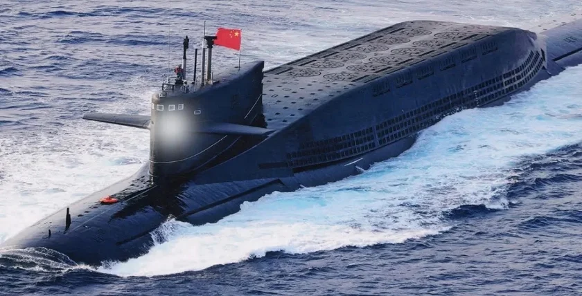
But the wider mapping of oceanic seabeds has been discussed in Chinese scientific papers and coincides with a major expansion of China’s nuclear submarine fleet, which is capable of carrying nuclear missiles. China is believed to have secretly launched two new classes of submarine this year alone—the long-awaited Type 095 nuclear submarine and a distinctive, unexpected “sailless” submarine without a conning tower, spotted in a Shanghai shipyard two weeks ago in satellite photos.
Raymond Powell, director of the Sealight Foundation, a US national security foundation, said that seabed mapping was important for the data China needed to hide its own submarines and also to find those of its opponents.
“I’d put the emphasis on finding everybody else’s,” he said. “In a Taiwan fight, US and allied attack submarines operating from deep water east of the island would be one of the hardest threats to counter: hard to find and able to threaten Chinese surface forces and amphibious shipping. That’s the threat all this seabed mapping is meant to neutralise.”
He said that China was now pushing further into the Pacific than it had gone before with such tactics. “It’s a classic grey-zone tactic,” he said. “China uses its navy to project capability, but it uses its civilian agencies to assert jurisdiction.”